Property Record
4025 Lexington Rd, Athens, GA 30605


NEARBY LISTINGS FOR SALE OR LEASE
-
-
View all Athens listings for lease on LoopNet.com
Property Detail
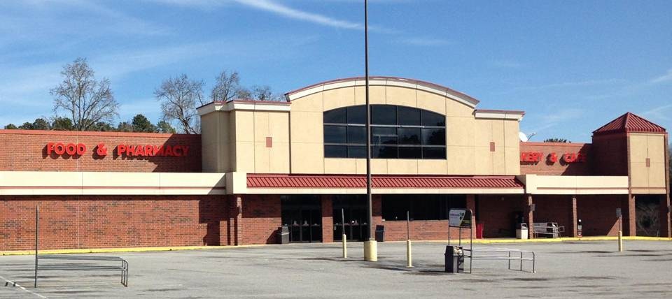
4025 Lexington Rd
233B4-C-005
Com-St-062->03-06
Publicstorage
DEEDED ACS: 5.018
X
Clarke
13059C0027E
Georgia
2024
5.14 AC
2024
Eastside Athens
140600
Other Market Areas
43,619 SF
Athens-Clarke County, GA
DEMOGRAPHICS near 4025 Lexington Rd
1 Mile
3 Mile
5 Mile
2024 Total Population
5,532
36,548
86,155
2029 Population
5,532
36,529
86,440
Pop Growth 2024-2029
0.00%
(0.05%)
+ 0.33%
Average Age
36
35
33
2024 Total Households
2,396
15,090
33,664
HH Growth 2024-2029
+ 0.04%
(0.05%)
+ 0.31%
Median Household Inc
$47,150
$50,505
$48,135
Avg Household Size
2.30
2.20
2.20
2024 Avg HH Vehicles
2.00
2.00
2.00
Median Home Value
$199,439
$198,293
$243,720
Median Year Built
1980
1986
1985
Nearby Places
- Restaurants
- Banks
- Shops
- Fitness
- Groceries
SALE & LEASE HISTORY
LISTING DATE
SALE/LEASE

Sep 24, 2016
For Sale
Nov 08, 2016
For Sale
Jan 26, 2017
For Lease
Nearby Properties
Address
Land Use
TOTAL SIZE
Lot Size
Zoning
Address
Land Use
TOTAL SIZE
Lot Size
Zoning
35 AC
G
Address
Land Use
TOTAL SIZE
Lot Size
Zoning
47.56 AC
G
Address
Land Use
TOTAL SIZE
Lot Size
Zoning
2,094.97 AC
G
Address
Land Use
TOTAL SIZE
Lot Size
Zoning
300,000 SF
122.56 AC
G
Address
Land Use
TOTAL SIZE
Lot Size
Zoning
225,000 SF
98.91 AC
G
Address
Land Use
TOTAL SIZE
Lot Size
Zoning
21.04 AC
G
Address
Land Use
TOTAL SIZE
Lot Size
Zoning
36.88 AC
G
Address
Land Use
TOTAL SIZE
Lot Size
Zoning
986 SF
40.54 AC
RM-1
Address
Land Use
TOTAL SIZE
Lot Size
Zoning
56.20 AC
G
Address
Land Use
TOTAL SIZE
Lot Size
Zoning
15.29 AC
RS-5
Address
Land Use
TOTAL SIZE
Lot Size
Zoning
26.76 AC
G
Address
Land Use
TOTAL SIZE
Lot Size
Zoning
28.91 AC
G
Address
Land Use
TOTAL SIZE
Lot Size
Zoning
4,014 SF
29.58 AC
RM-1
Address
Land Use
TOTAL SIZE
Lot Size
Zoning
6.01 AC
G
Address
Land Use
TOTAL SIZE
Lot Size
Zoning
1,624 SF
20.04 AC
RM-1
Address
Land Use
TOTAL SIZE
Lot Size
Zoning
22,920 SF
9.99 AC
RM-2
Address
Land Use
TOTAL SIZE
Lot Size
Zoning
6,288 SF
14.45 AC
CG
Address
Land Use
TOTAL SIZE
Lot Size
Zoning
2,062 SF
24.33 AC
RM-1
Address
Land Use
TOTAL SIZE
Lot Size
Zoning
124,959 SF
20.54 AC
E-I
Address
Land Use
TOTAL SIZE
Lot Size
Zoning
16.58 AC
G
Address
Land Use
TOTAL SIZE
Lot Size
Zoning
3,339 SF
16.80 AC
RM-1
Address
Land Use
TOTAL SIZE
Lot Size
Zoning
76.55 AC
RM-1
Address
Land Use
TOTAL SIZE
Lot Size
Zoning
153.94 AC
G
Address
Land Use
TOTAL SIZE
Lot Size
Zoning
143,200 SF
19.44 AC
RM-1
Address
Land Use
TOTAL SIZE
Lot Size
Zoning
14,000 SF
42.62 AC
I
Address
Land Use
TOTAL SIZE
Lot Size
Zoning
3,339 SF
5.91 AC
C-N
Address
Land Use
TOTAL SIZE
Lot Size
Zoning
47,808 SF
11.08 AC
RM-2
Address
Land Use
TOTAL SIZE
Lot Size
Zoning
16,800 SF
454.45 AC
G
Address
Land Use
TOTAL SIZE
Lot Size
Zoning
12.49 AC
G
Address
Land Use
TOTAL SIZE
Lot Size
Zoning
31.57 AC
G
The World's #1 Commercial Real Estate Marketplace
Connect with us
© 2025 CoStar Group
The information above has been obtained from sources believed reliable. While we do not doubt its accuracy we have not verified it and make no guarantee, warranty or representation about it. It is your responsibility to independently confirm its accuracy and completeness. Any projections, opinions, assumptions, or estimates used are for example only and do not represent the current or future performance of the property. The value of this transaction to you depends on tax and other factors which should be evaluated by your tax, financial, and legal advisors. You and your advisors should conduct a careful, independent investigation of the property to determine to your satisfaction the suitability of the property for your needs.